

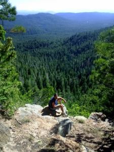
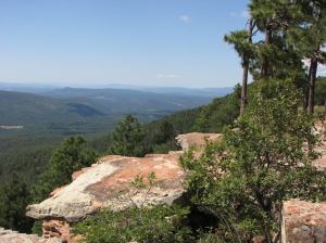
The MOGOLLON RIM (pronounced “muggy-own”) marks the southern limit of the Colorado Plateau and is one of Arizona’s most striking features. Rim visitors can stand 2,000 feet above the hot desert below and enjoy endless panoramic views from Mogollon’s rocky escarpment across mountainous abuttals. Arizona’s Grand Canyon is among the top geological wonders of the world; but the Mogollon Rim is Arizona’s most staunch geological feature.
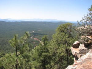
The Rim’s average elevation is about 7,000 feet and it stretches across the Coconino National Forest. Daily visitors arrive to see the expansive vistas above thousands of acres of the largest continuous stand of Ponderosa Pines in the world. On a clear day you can see all the way to Mount Lemmon.
What formed the Mogollon Rim? Geologists say this rock monster formed by catastrophic upturns and volcanism; followed by flooding and erosion during the Mesozoic Era. This time period would be approximately 65 to 250 million years ago. Important to note, Mesozoic Era started near the time of earth’s, well documented, mass extinction aka (the Great Dying) of non avian dinosaurs, most marine, insect and plant life.
Along the rim, evidence of volcanic activity is prolific and commands the landscape. Geographers have measured Mogollon’s volcanic, sedimentary rock bastion and found it to be over 200 miles long, reaching across Arizona’s Coconino National Forest. The uppermost sandstone layer of the rim is called Coconino Sandstone and it forms breathtaking white cliffs. This stratum of sandstone formed during the Permian Period, over 200 million years ago and is one of the thickest sandstones on earth.

The existence of the Mogollon Rim explains various weather events, drainage and runoff patterns, alluvial soil types, Arizona floods, water recreation and irrigation. When the warm, moist air from the Gulf of Mexico reaches the Mogollon Rim it rises up to meet the cold, drier Rim air where it condenses and falls. Prehistoric cultures thrived and expanded due to the dependable water from the Mogollon Rim.

A popular scenic drive is along Forest Road 300, aka “Rim Road”. It is labeled FR 300 on the Mogollon Rim map above and can be accessed from the east, near Show Low, or from the west, just north of Pine and Strawberry. According to the National Forest Website, all forest roads are gravelled and suitable for passenger vehicles; but are closed in the winter.
View Points and Vista Stops along Mogollon Rim
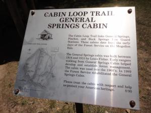
Forest Road 300 takes you along the rim’s edge with stops near historical cabins and trails, then winding turns through forest and highly populated wildlife areas. Some travelers stand on Mogollon’s vistas and try to absorb its majesty; while others spend a few days visiting local museums, learning the history and exploring the trails. Either way, add the Mogollon Rim to your list of places to visit, it will leave you breathless!
